Operational Oceanography (OO) can be defined as “the activity of systematic and long-term routine measurements of the seas and oceans and atmosphere, and their rapid interpretation and dissemination” (EuroGOOS, 2014). OO includes “a routinely collection, interpretation and presentation of data from the ocean and atmosphere with the purpose of giving a reliable description of the actual conditions of the ocean including its living resources, establishing a marine database from which time series and statistical analysis can be obtained for descriptions of trends and changes in the marine environment including consequences for the living conditions in, on and around the sea and providing prognoses for the future developments of the conditions in the sea” (Buch and Dahlin, 2000). In general terms, systematic observation includes remote sensing facilities (satellite, radar, etc.) and local and in-situ attended systems (moorings, ships of opportunity, regular research vessel cruises, etc.), together with autonomous or semiautonomous devices (sea level, buoys, drifters, gliders, profilers).
The term “fixed oceanographic stations” was defined as “oceanographic stations at which observations are taken continuously and periodically for periods of one year or more” (Landis, 2004). They consist in many different types of observations as CTD profiles with additional sensors, water samples at different levels for biogeochemical analysis (for nutrients, contaminants, chlorophyll-a, pH, alkalinity, phytoplankton abundance), plankton-net samples (for biomass and taxonomic composition), neuston net samples (for microplastics). An oceanographic station could consider also benthos samples, velocity profiles, deep moorings, etc.
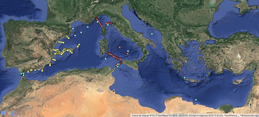
The following map shows the known Open Ocean Fixed Oceanographic Stations that are in operation in the Mediterranean Sea: