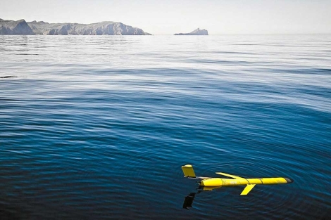
A glider is an underwater vehicle that uses small changes in its buoyancy in order to move up and down in the ocean. Unlike a float, a glider uses wings to convert that vertical motion to horizontal, propelling itself forward with very low power consumption.The high efficiency of the propulsion system enables gliders to be operated for several months, during which they can cover thousands of kilometers. They allow the autonomous and sustained collection of physical measurements such as pressure, temperature and conductivity data, and depending on the model, some biogeochemical measurements (like fluorescence, oxygen or optical backscattering) of the upper 1km of the ocean.Registred measurements are transmitted by satellite every time the gliders comes up to surface. The same communication channel is used to transmit navigation commands to the gliders (heading, angle of ascent/dive, max depth,…).
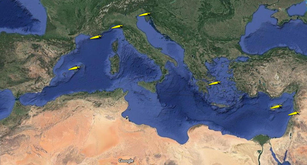
Although they are a relatively new platform in oceanography, in the Medtierranean Sea gliders are deployed regularly for ocean observations. Most of the active and archived glider missions can be tracked on the owners web site and also on the EGO (Everyone’s Gliding Observatories) web site. The following map shows the known Mediterranean Facilities available in the Mediterranean Sea: